Boundary records
The North Rose Fire District was established in law two years after the department received its charter, and enlarged in 1937 to take in territory lying partly in the Town of Rose and partly in the Town of Huron. The surviving papers — a tattered typescript of the boundary description, the certified enlargement resolution, and a 1950 letter from the Town Clerk — are reproduced here in chronological order.
- 17 April 1911
Boundaries of the North Rose Fire District as Established by Law
The earliest surviving description of the district's territory. The line begins in the center of Main Street in North Rose at the southern boundary of the Addison Dagle farm and runs easterly along that farm's south line to its southeast corner; thence northerly along the farm's east line and continuing in a straight line across the Rome, Watertown & Ogdensburg Railroad to the north line thereof; thence easterly to the most southern point on the boundary between the lands of Henry A. Lamb and Peter Salter; thence northerly along those farms to the center of the highway known as Wolcott or Graham Street.
From there the description continues easterly along the center of that highway to the east line of the land of Warren W. Morey; northerly along Morey's east line 34 rods and 15 feet; westerly parallel with Graham Street across the lands of J. C. Aldrich, Geo. W. Aldrich, the Fifth Road, and the lands of Ann Proseus to the center of Proseus Creek; thence following the center of the creek southerly across the lands of Ann Proseus, Geo. W. Aldrich, the RW&O Railroad, and the farm of Addison Dagle to the north line of the lands of John J. Miner; and thence easterly along the north line of the Miner farm to the place of beginning.
The department received its charter in 1915, and the accompanying narrative notes that the district was legally established as a fire district in 1917 — the description reproduced here carries the 1911 date under which the boundaries were set by law. The original page is tattered but legible and is reproduced below.
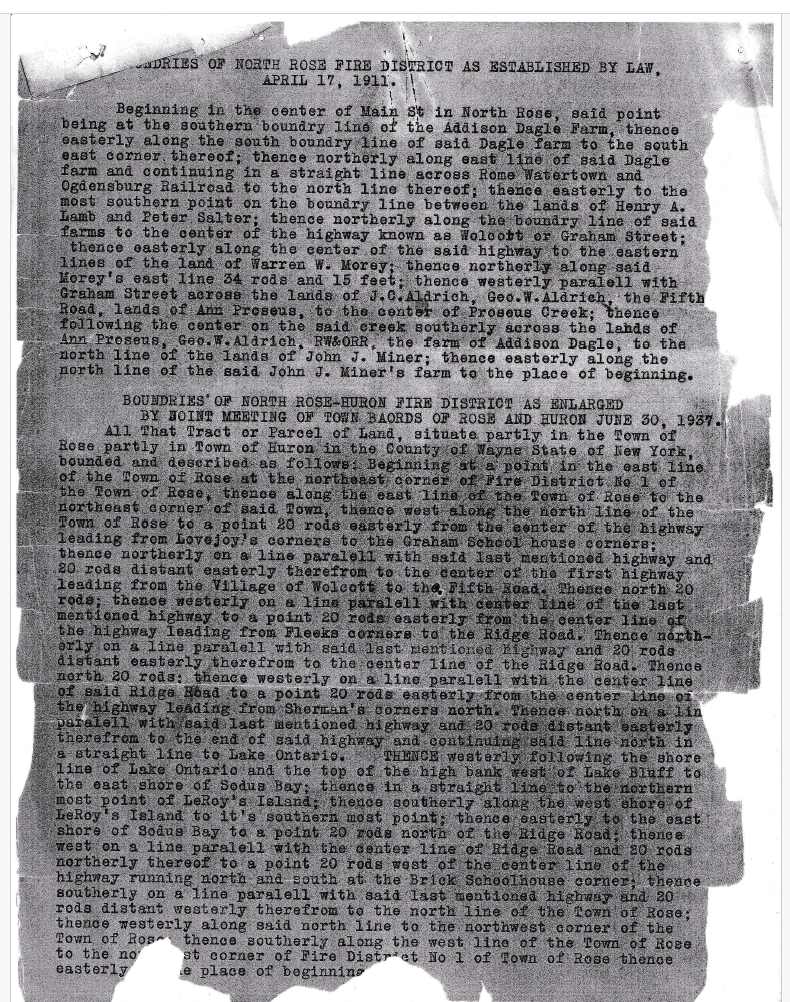
Typescript of the 1911 boundaries and, below it, the North Rose–Huron boundaries as enlarged 30 June 1937. - 30 June 1937
Enlargement of the District into the Town of Huron
A petition for enlargement was presented by F. J. Tague and others to a joint meeting of the Town Boards of Rose and Huron on 8 June 1937. The boards ordered a public hearing for 30 June 1937 at eight o'clock P.M. at the residence of H. B. Thomas in the Town of Huron, with notice published in The Lake Shore News of Wolcott on 17 June 1937 and posted in not fewer than five public places within the affected territory.
At that joint meeting the boards found the petition properly signed, acknowledged, and proved in the same manner as a deed to be recorded, and in compliance with Section 171 of the Town Law. Having heard all owners of taxable real property and all other interested persons, the boards resolved that granting the petition in whole was in the public interest and that all benefited property and property owners were included.
The enlarged territory — situate partly in the Town of Rose and partly in the Town of Huron — runs from the northeast corner of Fire District No. 1 north along the east line of the Town of Rose, then by a series of lines set twenty rods off the centers of the highways from Lovejoy's corners, Fleeks corners, and Sherman's corners, continuing north in a straight line to Lake Ontario. From the lake it follows the shore line and the top of the high bank west of Lake Bluff to the east shore of Sodus Bay, thence to the northernmost point of LeRoy's Island, along the island's west shore to its southernmost point, back to the east shore of Sodus Bay, and south and west by lines parallel to the Ridge Road and the Brick School House corner highway to the place of beginning.
The certified copy carries the seals and signatures of Alice R. Allen, Town Clerk of the Town of Rose, and T. S. Fowler, Town Clerk of the Town of Huron, each certifying unanimous adoption by their board on 30 June 1937.
- 2 March 1950
Town Clerk's Letter on the Boundary Record
Harry E. Partrick, Town Clerk of the Town of Rose, wrote from the Office of the Town Clerk in North Rose to a correspondent he addressed as "Friend Whitey," enclosing copies of the original petition setting up the boundaries of the North Rose Fire District and the 30 June 1937 petition extending the boundaries of the North Rose–Huron District.
Partrick candidly reported a gap in the record that remains open today: he could not find when or how the North Rose District was enlarged to cover the part of the Town of Rose not incorporated in the Rose District as it then stood. He suggested writing Walter Miller, County Superintendent of Highways at Lyons, who held good copies of Wayne County maps on which the fire district boundaries could be outlined.
But I cannot find when or how the North Rose District was enlarged to cover that part of the Town of Rose not incorporated in the Rose District, as it now stands.
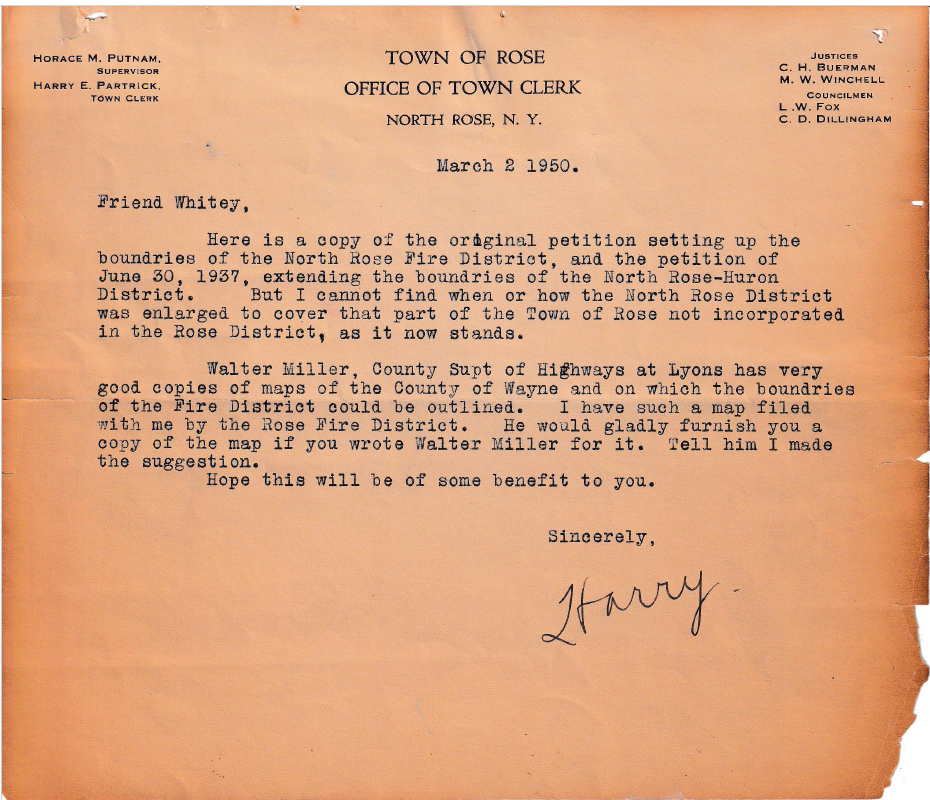
Letter of 2 March 1950 from Town Clerk Harry E. Partrick, Town of Rose, enclosing the original and 1937 boundary petitions.